Pre-conference Workshop
Pre-conference workshop on "Open source hands-on GIS workshop for disaster management using QGIS and GRASS" will be delivered by Prof. Scott Madry from the University of North Carolina, USA.
Waterloo Institute for Disaster Management (WIDM) and Department of Geography & Urban Planning, College of Humanities & Social Sciences, United Arab Emirates University jointly organize one day workshop during the joint EOGC-GIT4NDM 2015 conference.
The workshop is co-sponsored by the International Society for Photogrammetry and Remote Sensing (ISPRS), the International Cartographic Association (ICA), International Federation of Surveyors (FIG) and the International Association of Geo-information & Communication Technology (AGeoICT).
Workshop Overview
This workshop will introduce the use of Free and Open Source GIS software for disaster planning and response applications. Both Quantum GIS (QGIS) and the Geographical Resources Analysis Support System (GRASS) will be used. There are no prerequisites, and no previous GIS experience is required. Participants are encouraged to bring their own computers to load the software and data.
Objectives
The goal is to have each participant capable of downloading the current version of the software, locating relevant data, and mastering the basics of using QGIS and GRASS for their own disaster work.
Workshop Content
The workshop will present an overview of several applications of GIS, satellite remote sensing and GPS for disaster management, and will provide a basic introduction to QGIS and its GRASS plug-in and how they can be used effectively in disaster planning, response and recovery. Participants will learn how to download the software (Windows, Mac or Linux), where to find help and various online resources for disaster GIS, and will be provided with specific examples of the use of these for disaster applications. The hands-on activities will center on learning the basic use and capabilities of QGIS for the display, analysis, printing and sharing of spatial data. A brief introduction to how these technologies fit together, where this is all going. The new and emerging area of 'citizen science' and 'remote disaster support', including the emerging use of social media tools, will be presented. An example of running the same software from a thumb drive will be demonstrated.
Training Venue and Accommodations
The program will be held at United Arab Emirates University, Al Ain, UAE. Accommodations can be made at a hotel near to the venue.
Policies
All instruction and materials are in English, but the QGIS software and documentation are available in a number of languages.
Registration Fees
One day workshop registration fees is $250 for early bird registration (before the 1st of October 2015), $300 after the 1st October .
Faculty
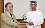
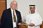
Professor Scott Madry is a research associate professor of archaeology at the University of North Carolina at Chapel Hill and is on the faculty of the International Space University in Strasbourg, France. He has been involved in the application of advanced space technologies (satellite remote sensing, GIS and GPS) for disaster management for over 15 years, and lectures on the topic widely. He has participated in numerous disaster responses as a volunteer with the American Red Cross and is active in the GISCorps and has participated in remote disaster support operations in Myanmar, Australia and the USA. In 2012 he was awarded, along with the other GISCorps volunteers, the President's Volunteer Service Award by President Barak Obama. His book entitled Space Systems for Disaster Warning, Response and Recovery has been published by Springer press in 2014.
Contents
Hands-on work with QGIS and GRASS, adding existing data, creating new data (digitizing),
accessing data over the web, integrating remote sensing data, integrating GPS data,
producing hard-copy maps and sharing maps via the web.
using the InaSAFE plugin for assessment after a disaster, using QGIS on a flash drive-based
system, web resources, the emerging role of social media in disaster response, citizen
input and remote data analysis, future directions, final discussions and conclusions.
• Abstracts Proceedings (Final)
• Complete Conference Program (Final)


Video by Abu Dhabi TV Covering the Conference

Submission of abstracts: 30 September 2015
Notification of acceptance: 15 October 2015
Full papers submission: 31 October 2015
Early bird registration extended to: 31 October 2015
Registration Deadline: 30 November 2015
Conference Documents